
A powerful Nor’easter is making its way toward Massachusetts and much of southern New England, prompting the National Weather Service (NWS) to issue Blizzard Warnings and Winter Storm Warnings across large portions of the state. As conditions are expected to deteriorate rapidly from Sunday afternoon, officials are warning of dangerous and potentially life-threatening weather that will impact travel and daily activities through Monday morning.
Snow and Wind: What to Expect
The most severe weather conditions are expected to affect eastern, northeastern, and southeastern Massachusetts, particularly the Boston-to-Providence corridor. The NWS office in Boston/Norton upgraded the earlier Winter Storm Watch to a Blizzard Warning, set to be in effect from 4 p.m. Sunday until 7 a.m. Tuesday.
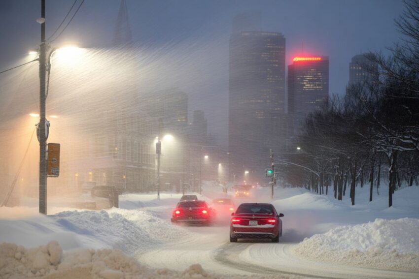
The storm is expected to bring 1 to 2 feet of snow, with wind gusts reaching up to 60 mph. These extreme weather conditions will create near-zero visibility at times, with whiteout conditions that will make travel extremely hazardous. In its urgent winter weather message, the National Weather Service warned that travel could be extremely difficult or impossible in some areas.
Hazardous Travel Conditions
Under the criteria for a Blizzard Warning, sustained winds or frequent gusts of at least 35 mph, combined with blowing snow, will reduce visibility to less than a quarter mile for extended periods. This is expected to occur primarily from Sunday evening through Monday afternoon, especially along the coast and in heavily impacted regions.
The storm will severely affect Monday morning and evening commutes, with travel conditions worsening rapidly. Authorities are urging people to avoid non-essential travel during the worst parts of the storm. Those who must travel are advised to carry a winter survival kit in their vehicles, including essential items like food, water, flashlights, blankets, and extra batteries. If you are stranded, it is recommended to stay with your vehicle for safety.
Power Outages and Infrastructure Concerns
The combination of wet, heavy snow and strong winds will likely result in downed tree limbs and power lines, which could lead to widespread power outages in affected areas. Urban and coastal communities, including Boston, Quincy, Plymouth, and Gloucester, are under the highest level of alert. Officials are monitoring these areas closely and preparing for potential infrastructure issues.
In addition, residents in the affected areas are encouraged to secure outdoor items, charge electronic devices in advance, and check on vulnerable neighbors to ensure their safety during the storm.
Winter Storm Warnings Across Interior Regions
While eastern Massachusetts braces for the heaviest snow and blizzard conditions, central and western Massachusetts will experience significant snowfall as well, under Winter Storm Warnings. These regions could see 10 to 20 inches of snow, with wind gusts reaching up to 45 mph. In areas such as northern Berkshire County and other elevated regions, snowfall rates could exceed 1 inch per hour during the peak of the storm.
The storm will also impact neighboring regions, including parts of Connecticut and eastern New York, where additional Blizzard Warnings and Winter Storm Warnings have been issued. These areas are expected to see snow accumulations between 8 and 20 inches, depending on location and elevation.
Regional Coordination and Public Safety Efforts
The Nor’easter is a classic storm system known for rapidly intensifying along the East Coast, producing heavy snow, strong winds, and significant coastal flooding. Transportation departments across Massachusetts have prepared plow and salt crews for the impending storm, while utility companies are on standby to address potential outages.
Officials are also emphasizing the importance of early preparation. Final storm preparations should be completed on Saturday, with residents advised to stay informed through local weather updates and official advisories.
The Storm’s Long-Term Impact
In addition to hazardous travel conditions, the storm’s impact is expected to be long-lasting. Even after the storm begins to taper off on Monday afternoon, cold temperatures will persist, and many areas will remain covered in snow. The storm will also test the state’s infrastructure as the combination of heavy snow and powerful winds will challenge emergency response teams.
As the storm moves through New England, communities are bracing for its impact while taking steps to mitigate the effects of the powerful system. The National Weather Service continues to monitor the storm closely, and more updates are expected as the situation develops.
Conclusion: Stay Prepared and Stay Safe
The upcoming Nor’easter is shaping up to be one of the most significant winter storms of the year for Massachusetts and surrounding areas. With Blizzard Warnings, Winter Storm Warnings, and a forecast for up to 2 feet of snow combined with high winds, residents are urged to take immediate precautions. While Monday’s commute will likely be severely disrupted, the storm will also serve as a reminder of the need for winter weather preparedness.
Residents should ensure they have all necessary emergency supplies, avoid non-essential travel, and stay updated on the latest storm developments. The storm’s heavy snow, high winds, and potential power outages will continue to create challenges for those in affected areas.
The post Massachusetts on Edge as Massive Blizzard Hits: Snow, Winds, and Chaos Expected appeared first on Travel And Tour World.